
Category:SVG maps of the history of Indonesian provinces
| NO WIKIDATA ID FOUND! Search for SVG maps of the history of Indonesian provinces on Wikidata | |
| Upload media |
Derived from File:Indonesia location map.svg
Subcategories
This category has only the following subcategory.
B
Media in category "SVG maps of the history of Indonesian provinces"
The following 74 files are in this category, out of 74 total.
-
.png/120px-2019_Indonesian_Legislative_Election_Map_(2).png) 2019 Indonesian Legislative Election Map (2).png 2,000 × 938; 356 KB
2019 Indonesian Legislative Election Map (2).png 2,000 × 938; 356 KB
-
 2019 Indonesian Legislative Election Map.png 1,500 × 590; 220 KB
-
 2019 Indonesian legislative election results map by electoral district.svg 1,748 × 1,137; 856 KB
-
 Eight Indonesian provinces - 1945.svg 1,415 × 600; 398 KB
-
 Eleven Indonesian provinces - 1950.svg 1,411 × 600; 304 KB
-
 Four Javanese province - 1950.svg 1,733 × 600; 25 KB
-
 Indonesia provinces 1945.svg 1,200 × 460; 902 KB
-
 Indonesia provinces 1946.svg 1,200 × 460; 896 KB
-
 Indonesia provinces 1950.svg 1,200 × 460; 900 KB
-
 Indonesia provinces 1956-a.svg 1,200 × 460; 905 KB
-
 Indonesia provinces 1956-b.svg 1,200 × 460; 906 KB
-
 Indonesia provinces 1958-a.svg 1,200 × 460; 906 KB
-
 Indonesia provinces 1958-b.svg 1,200 × 460; 909 KB
-
 Indonesia provinces 1958-c.svg 1,200 × 460; 910 KB
-
 Indonesia provinces 1959.svg 1,200 × 460; 910 KB
-
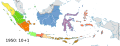
 Indonesia provinces 1960.svg 1,200 × 460; 912 KB
-
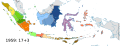
 Indonesia provinces 1963.svg 1,200 × 460; 911 KB
-
 Indonesia provinces 1964-a.svg 1,200 × 460; 912 KB
-
 Indonesia provinces 1964-b.svg 1,200 × 460; 912 KB
-
 Indonesia provinces 1964-c.svg 1,200 × 460; 914 KB
-
 Indonesia provinces 1967.svg 1,200 × 460; 917 KB
-
 Indonesia provinces 1976.svg 1,200 × 460; 914 KB
-
 Indonesia provinces 1999-a.svg 1,200 × 460; 916 KB
-
 Indonesia provinces 1999-b.svg 1,200 × 460; 916 KB
-
 Indonesia provinces 2000-a.svg 1,200 × 460; 916 KB
-
 Indonesia provinces 2000-b.svg 1,200 × 460; 916 KB
-
 Indonesia provinces 2000-c.svg 1,200 × 460; 916 KB
-
 Indonesia provinces 2001.svg 1,200 × 460; 917 KB
-
 Indonesia provinces 2002.svg 1,200 × 460; 917 KB
-
 Indonesia provinces 2004.svg 1,200 × 460; 918 KB
-
 Indonesia provinces 2012.svg 1,200 × 460; 935 KB
-
 Indonesia provinces 2022.svg 1,200 × 460; 983 KB
-
 Indonesia provinces fertility rate 2017.svg 1,185 × 450; 394 KB
-
 Indonesia provinces HDI 2014.svg 1,322 × 620; 175 KB
-
 Indonesia provinces HDI 2015.svg 1,587 × 744; 383 KB
-
 Indonesia provinces HDI 2017.svg 2,000 × 767; 433 KB
-
 Indonesia provinces HDI 2018.svg 512 × 196; 297 KB
-
 Indonesia provinces HDI 2019.svg 512 × 196; 297 KB
-
 Indonesia provinces HDI 2020.svg 1,185 × 450; 302 KB
-
 Indonesia provinces HDI 2021.svg 1,875 × 750; 370 KB
-
 Indonesia provinces HDI 2022.svg 1,551 × 571; 166 KB
-
 Indonesia provinces HDI 2023.svg 1,551 × 571; 166 KB
-
 Indonesia provinces HDI 2024.svg 1,551 × 571; 166 KB
-
 Indonesia provinces HDI 2025.svg 1,551 × 571; 166 KB
-
 Indonesia provinces population density 2015.svg 512 × 196; 297 KB
-
 Indonesia provinces population density 2020.svg 1,185 × 450; 394 KB
-
 Indonesian special regions - 1945.svg 771 × 599; 11 KB
-
 Japanese West Coast Sumatra location.svg 853 × 781; 3.75 MB
-
.svg/120px-Map_of_2019_Indonesian_Presidential_Election_-_Provinces_(with_gradation).svg.png)
-
.svg/120px-Old_map_of_Central_Sumatra_(before_1958).svg.png) Old map of Central Sumatra (before 1958).svg 245 × 210; 858 KB
Old map of Central Sumatra (before 1958).svg 245 × 210; 858 KB
-
.svg/120px-Old_map_of_East_Kalimantan_(before_2012).svg.png) Old map of East Kalimantan (before 2012).svg 179 × 158; 860 KB
Old map of East Kalimantan (before 2012).svg 179 × 158; 860 KB
-
.svg/120px-Old_map_of_Kalimantan_(1956).svg.png) Old map of Kalimantan (1956).svg 179 × 158; 861 KB
Old map of Kalimantan (1956).svg 179 × 158; 861 KB
-
.svg/120px-Old_map_of_Kalimantan_(blank).svg.png) Old map of Kalimantan (blank).svg 179 × 158; 860 KB
Old map of Kalimantan (blank).svg 179 × 158; 860 KB
-
.svg/120px-Old_map_of_Maluku_(before_1999).svg.png) Old map of Maluku (before 1999).svg 184 × 191; 862 KB
Old map of Maluku (before 1999).svg 184 × 191; 862 KB
-
.svg/120px-Old_map_of_North_Sulawesi_(before_1964).svg.png) Old map of North Sulawesi (before 1964).svg 165 × 212; 862 KB
Old map of North Sulawesi (before 1964).svg 165 × 212; 862 KB
-
.svg/120px-Old_map_of_North_Sulawesi_(before_2000).svg.png) Old map of North Sulawesi (before 2000).svg 165 × 212; 863 KB
Old map of North Sulawesi (before 2000).svg 165 × 212; 863 KB
-
.svg/120px-Old_map_of_North_Sumatra_(before_1956).svg.png) Old map of North Sumatra (before 1956).svg 245 × 210; 857 KB
Old map of North Sumatra (before 1956).svg 245 × 210; 857 KB
-
.svg/120px-Old_map_of_Papua_(before_2001).svg.png) Old map of Papua (before 2001).svg 201 × 169; 862 KB
Old map of Papua (before 2001).svg 201 × 169; 862 KB
-
.svg/120px-Old_map_of_Riau_(before_2002).svg.png) Old map of Riau (before 2002).svg 245 × 210; 866 KB
Old map of Riau (before 2002).svg 245 × 210; 866 KB
-
.svg/120px-Old_map_of_South_Kalimantan_(before_1958).svg.png) Old map of South Kalimantan (before 1958).svg 179 × 158; 859 KB
Old map of South Kalimantan (before 1958).svg 179 × 158; 859 KB
-
.svg/120px-Old_map_of_South_Sulawesi_(before_1964).svg.png) Old map of South Sulawesi (before 1964).svg 165 × 212; 862 KB
Old map of South Sulawesi (before 1964).svg 165 × 212; 862 KB
-
.svg/120px-Old_map_of_South_Sulawesi_(before_2004).svg.png) Old map of South Sulawesi (before 2004).svg 165 × 212; 863 KB
Old map of South Sulawesi (before 2004).svg 165 × 212; 863 KB
-
.svg/120px-Old_map_of_South_Sumatra_(before_1964).svg.png) Old map of South Sumatra (before 1964).svg 245 × 210; 862 KB
Old map of South Sumatra (before 1964).svg 245 × 210; 862 KB
-
.svg/120px-Old_map_of_South_Sumatra_(before_1967).svg.png) Old map of South Sumatra (before 1967).svg 245 × 210; 864 KB
Old map of South Sumatra (before 1967).svg 245 × 210; 864 KB
-
.svg/120px-Old_map_of_South_Sumatra_(before_2000).svg.png) Old map of South Sumatra (before 2000).svg 245 × 210; 866 KB
Old map of South Sumatra (before 2000).svg 245 × 210; 866 KB
-
.svg/120px-Old_map_of_Sulawesi_(1960).svg.png) Old map of Sulawesi (1960).svg 165 × 212; 864 KB
Old map of Sulawesi (1960).svg 165 × 212; 864 KB
-
.svg/120px-Old_map_of_Sulawesi_(blank).svg.png) Old map of Sulawesi (blank).svg 165 × 212; 864 KB
Old map of Sulawesi (blank).svg 165 × 212; 864 KB
-
.svg/120px-Old_map_of_Sumatra_(1950).svg.png) Old map of Sumatra (1950).svg 245 × 210; 859 KB
Old map of Sumatra (1950).svg 245 × 210; 859 KB
-
.svg/120px-Old_map_of_Sumatra_(blank).svg.png) Old map of Sumatra (blank).svg 245 × 210; 859 KB
Old map of Sumatra (blank).svg 245 × 210; 859 KB
-
.svg/120px-Old_map_of_West_Java_(before_2000).svg.png) Old map of West Java (before 2000).svg 187 × 65; 862 KB
Old map of West Java (before 2000).svg 187 × 65; 862 KB
-
.svg/120px-Province_of_East_Timor_in_Indonesia_(1976–1999).svg.png) Province of East Timor in Indonesia (1976–1999).svg 1,200 × 460; 921 KB
Province of East Timor in Indonesia (1976–1999).svg 1,200 × 460; 921 KB
-
 Surakarta Special Region dissolution - 1946.svg 771 × 599; 9 KB
-
 Three Sumatran provinces - 1948.svg 700 × 600; 65 KB
-
 Yogyakarta Special Region formation -1950.svg 1,000 × 600; 7 KB
.png)


.svg)
.svg)
.svg)
.svg)
.svg)
.svg)
.svg)
.svg)
.svg)
.svg)
.svg)
.svg)
.svg)
.svg)
.svg)
.svg)
.svg)


.svg)
.svg)
.svg)
.svg)
.svg)
.svg)